Showing posts with label Willett Branch Stream. Show all posts

Saturday, November 06, 2021

Alarming E.coli count found in Willett Branch stream in Bethesda


Advocates for the Little Falls watershed have been taking water samples from the Willett Branch and Little Falls Branch of the stream in Bethesda for several months, finding that a number of locations had E.coli bacteria counts that exceed the standards for safe water play for humans and animals. The Little Falls Watershed Alliance then sought a more refined testing procedure, to find out what the problem was. Results of those new tests show the contamination is even worse than originally believed.


The newest tests, conducted by the Potomac Riverkeepers Network (PRKN) Rapid Response team, show alarmingly high counts of E.coli at each location where samples were taken. Maryland standards for safe water play allow E. coli levels of 0 to 410 MPN/100ml. A Willett Branch sample taken 300 feet upstream from the Bethesda Pool shows an E.coli level of 12,667.5 MPN/100ml. 


Because a sample taken from a small inlet entering the Bethesda Pool-area stream channel shows "only" 977.5 MPN, and the E.coli counts drop to "only" 8,664.0 and 4,352.0 (south of the pool and by Morgan Drive, respectively), watershed advocates believe there is either a rupture of a sewer line near the Purple Line construction site, or an illegal sewer hookup discharging from a building in that area. The stream was once above-ground there, but was placed underground as Bethesda urbanized.

LFWA and PRKN have reported the situation to Montgomery County and WSSC officials. It will now be up to them to investigate and determine the source of the E.coli. In the meantime, think twice before allowing children or pets to enter the stream.

Top photo: Robert Dyer / Chart & map courtesy Little Falls Watershed Alliance

Friday, July 09, 2021

Half of Little Falls watershed samples fail most recent E. coli test


E. coli tests of samples from two stream branches of the Little Falls watershed in Bethesda show half of the samples did not meet Maryland or District of Columbia standards for water quality. Samples of stream water collected near the Bethesda public pool (Willett Branch) and south of the Massachusetts Avenue bridge (Little Falls Branch) exceeded the "safe" level of E. coli contamination. 


Samples taken upstream from the Somerset Pool (Little Falls Branch) and on the Potomac River side of MacArthur Boulevard near Brookmont (Little Falls Branch) passed, however. The samples were collected, and results reported, by the Little Falls Watershed Alliance

Monitoring E. coli contamination can help alert authorities to sewage leaks in the watershed. But fecal contamination also comes from uncollected pet waste and wildlife that ends up in the streams.

Photo by Robert Dyer
Chart by Little Falls Watershed Alliance

Friday, December 08, 2017

Westbard Self Storage opponents launch petition

Residents who oppose the current plans for a new Westbard Self Storage development behind the McDonald's on River Road have launched an online petition. It criticizes the dimensions and appearance of the building, the stormwater management plan, and the width of the planned public path that will provide access to the future Willett Branch greenway between the self-storage facility and the McDonald's. Representatives for the self-storage project have told Montgomery County planners they believe their plan meets or exceeds all architectural, design and environmental requirements.

The Montgomery County Planning Board will take up the matter next Thursday, December 14, 2017, at the Planning Department headquarters, located at 8787 Georgia Avenue in Silver Spring.

Wednesday, November 29, 2017

Little Falls watershed advocates press for changes to Westbard Self Storage project

Members of the Little Falls Watershed Alliance are calling for changes to the stormwater management, pedestrian pathway and aesthetic appearance of a proposed self storage project behind the McDonald's on River Road. They've outlined their criticisms and recommended changes in an email to Montgomery County planners. You can add your voice by sending an email to the property owner, and linking to the LFWA's summary, letting him know you support these changes as well. Advocates are concerned about the environmental and aesthetic impacts of the building on the Willett Branch stream, and on the future greenway park alongside it.
Willett Branch stream

Monday, July 24, 2017

Westbard lawsuit adds MoCo Housing Opportunities Commission as defendant

Plaintiffs suing Montgomery County over the validity and impacts of the Westbard sector plan have amended their complaint to add the County Housing Opportunities Commission as a defendant. The amended complaint alleges that both defendants conspired behind the scenes to ensure that property-specific heights and densities would be provided for in the plan (contract zoning, which is illegal), environmental standards related to the Willett Branch stream buffers would be modified, and that an African-American cemetery on the Westwood Tower site would remain concealed from the public. Both defendants and developer Regency Centers/Equity One stand to benefit from a transaction they are party to, the Westwood Tower property and its redevelopment.

These 3 "benefits," only applicable to the Westwood Tower site, were given to HOC in exchange for HOC providing a specific number of affordable housing units above the amount required by County law. They also would ensure that the mutually-beneficial Westwood Tower deal would be achieved. Importantly, the negotiations on this deal were conducted outside of the public process.

The amended complaint gives a detailed history of the dealings on Equity One's planned redevelopment and the Westwood Tower issue, beginning with County Councilmember Roger Berliner (D - District 1) being contacted by Equity One's zoning attorney in February 2012, regarding getting the then-postponed Westbard sector plan rewrite back on track. In September 2012, the County Department of Housing and Community Affairs secretly approved a "Certificate of Compliance" and an "Agreement Not to Convert," both necessary to facilitate the purchase of Westwood Tower by Equity One. 

The public announcement of Equity One's purchase of the tower and several other Westbard properties did not come until October 2012. For that transaction to occur, Montgomery County, Equity One and the HOC had to have negotiated behind the scenes prior to the sale, the suit notes. Mysteriously, the same day the plan to purchase the properties was announced, the Montgomery County Planning Board declared the Westbard sector plan was being reopened for amendment.

As part of its purchase of the so-called "Westwood Complex" from then-owner Capital Properties (who bought it from the Tauber family), Equity One paid $25 million for Westwood Tower in June 2013. Currently, the HOC is poised to buy Westwood Tower from Equity One for only $20 million, $5 million less than Equity One paid for it four years ago.

The amended complaint also provides new details regarding the cemetery cover-up. Planning staff ruled internal communications regarding the cemetery as "Confidential" in September 2015. As I previously reported, planning staff agreed to remain silent on the existence of the cemetery during a September 17, 2015 Planning Board tour of "Westbard."

Pointing to notes taken by Park & Planning staff during conversations with the son of the architect of Westwood Tower, the lawsuit refers to his account of remains being encountered when the cemetery was desecrated during construction of the building during the late 1960s. Dr. Lazlo Tauber, the original developer of Westwood Tower, is implicated in those recollections as having told the architect to leave bodies there and pave over them.

Another new detail about the cemetery is that the architect had to "fix the drainage at that corner of the building because they were worried that if water didn't drain, it would cause erosion, and bodies would come up." While evidence has pointed to some remains being pushed into a pit downward from the rear of the building, and a few being taken by the architect to Howard Chapel Cemetery for secret unmarked reburial, the recollections of his son in the notes clearly underline that most bodies remain on the site. Dr. Tauber "thought that leaving them there, paving over them was probably the best thing to do - leave in place."

This not only further suggests remains are still on the site, but is the first evidence that Tauber was part of the cover-up of the cemetery desecration. Another piece of evidence not referred to in the lawsuit, is the fact that the architect knew the remains were of African-Americans, as evident by his selection of Howard Chapel for reburial. How did he know that, unless someone such as Tauber informed him that there was an African-American cemetery on the site. We still don't know if it was Tauber, or someone else prior, who bulldozed or removed the gravestones in the 1950s.

With all of this in mind, the lawsuit alleges, the defendants and Equity One conspired to keep the cemetery information from the public, to prevent greater public opposition. Documents related to the construction of Westwood Tower, which the lawsuit alleges were in the possession of Equity One, conveniently got shredded in 2015.

HOC did not publicly announce its plan to build a parking garage and apartment building on top of the cemetery behind Westwood Tower until long after the County Council passed the Westbard sector plan in May 2016. But in a February 11, 2016 email to the County Council, HOC stated that "Equity One, who currently owns the [Westwood Tower] property, approached HOC almost two years ago to collaborate on development plans." The lawsuit adds that the email also referred to a "joint development agreement" between HOC and Equity One.

On April 22, 2017, Equity One stated in a letter that it would facilitate the HOC project through "significant financial contributions." The suit alleges these contributions will include "real property and construction costs in the millions of dollars." It notes that, since all parties claim no documents regarding their terms of agreement exist, the Westbard sector plan is then the only codification of the terms of agreement.

The Willett Branch stream buffers were dealt with in similar fashion, the lawsuit alleges, citing a February 2016 HOC letter that declared "the 'key obstacle' to the redevelopment of the [Westwood Tower] HOC property 'is the presence of [a] Stream Valley Buffer.'" It was made clear that only by weakening the rules regarding the width of the buffer would the HOC redevelopment be possible.

Terms of the contract zoning agreement for providing more MPDUs on the Westwood Tower HOC site resulted in a financial benefit for Equity One, the lawsuit states, as they could build more market rate units. A Council staff member advised the Council in an email not to publicly discuss that financial benefit for Equity One, saying, "I am hoping it does not come up."

By engaging in these type of agreements in illegal contract zoning, and ratifying them in the Westbard sector plan document, the lawsuit concludes, the sector plan is thereby "the de facto illegal contract in furtherance of an illegal zoning scheme," and must be rendered void.

A hearing has been scheduled for August 16, at which the judge's ruling will determine whether the case goes forward to trial or not.

Friday, December 09, 2016

Pastor on possibility Westwood Tower construction crews desecrated African-American cemetery: "This is a story that has to be told"

The cemetery property is now
bisected by the relocated
Willett Branch stream (right)
Special report

A crowd of Bethesda residents packed into an upper room at the Westmoreland Congregational Church of Christ last night heard the first public reaction from members of the Macedonia Baptist Church to the likely desecration of an African-American cemetery by construction workers in the late 1960s. Dr. Sterling King, Jr., pastor emeritus of Macedonia Baptist Church, said that if remains were indeed moved without permission, "this is really a crime as defined by the Hague convention."

At least one eyewitness has recalled construction workers building the Westwood Tower apartments at 5401 Westbard Avenue stopping work 12 times, after encountering 12 graves during excavation for the building. After the 12th stoppage, someone at the construction site ordered workers to no longer stop, and to illegally relocate any further human remains found to an unknown location downward from the rear of the property. The specific location, as well as the fate of the first 12 sets of remains, are unknown at this time.

"Who did it? Under
what authority did they
do it?"

Either the remains are still there, King said, or they were moved. He said they could even have ended up "in a dumpster. Who did it? Under what authority did they do it? And what are the repercussions?"

If the remains were moved or removed, King said, "certain charges can be conferred. The perpetrators could be called upon to give an explanation."

King stressed the sacred nature of cemeteries in Judeo-Christian tradition, among other cultures. "Burial sites are very, very sacred grounds," he said. "Any misuse or abuse must be taken seriously. We are interested in the outcome of this."

"This is really
a crime"

The meeting, which was organized and sponsored by the Little Falls Watershed Alliance, featured three speakers who presented a detailed history of the "Westbard" area. Amy Rispin, who previously has written a history of the Brookdale community, and Paige Whitley covered the earliest periods of time. David Kathan, who spoke on the history of the cemetery (which was established in 1911 by White's Tabernacle No. 39, Ancient Order of United Brothers and Sisters, Sons and Daughters of Moses), said there are no records of official burials or removals at the graveyard since 1958, when the WSSC purchased a right-of-way through the cemetery when relocating the Willett Branch stream south of its natural location.

"Records are not as pristine as we often think they are," King said, which reflects a troubling pattern in Montgomery County regarding African-American properties. Farm Road is perhaps the most notorious case.

King said he experienced something similar when he tried to obtain a plat for the Macedonia Baptist Church in the late 1990s. After a lengthy search through County records in Rockville, King recalled, "Would you believe...nothing shows up." The church eventually had to hire a private surveyor, who found the County had illegally taken part of the church's land for a road that runs between it and Bank of America.

"These developers never stop," King said. "There's been a string of efforts to get our church off of the hill."

While Planning Department staff and the newest owners of Westwood Tower, Equity One (Regency Centers) and the Montgomery County Housing Opportunities Commission, have said they support attempting to confirm the presence or removal of gravesites on the property, King's stronger words were sorely needed. This is not simply a real estate matter. It is a moral and legal outrage.

The LFWA is lobbying against plans by Equity One and HOC to extend the developed area of their property further into the Willett Branch stream buffer and graveyard footprint. They also are leading the effort to establish a Willett Branch Stream greenway park. It will take community support to make the park a reality. It will also take community attention to the cemetery matter to ensure that we get the answers needed, and solve the mystery of exactly what happened. One troubling reality is that, even if human remains are found now, Maryland law has an official process that allows for the removal of graves to make way for real estate development or public infrastructure.

If "fill" dirt and related debris from the excavation of the Westwood Shopping Center is now on top of the gravesites, it could block ground penetrating radar from showing anything. One attendee at last night's meeting suggested such radar can't reach beyond two feet of depth.

But other methods are available. Mechanical stripping was used in Alexandria to locate graveshafts. I've found some articles on various methods used to locate other missing historical cemeteries in Bibb County, Georgia, where the Georgia clay renders radar useless; and the use of dowsing (yes, like dowsing for water) in Iowa and shovel test pits.

Last night's meeting also confirmed the existence of one other cemetery I had heard of (on the Washington Episcopal School property edge at Little Falls Parkway), and another I hadn't - on the edge of The Kenwood condo property at the final bend as you approach River Road southbound. I have been searching for the locations of the White's Tabernacle cemetery and others since 2011, when the Montgomery County Planning Board and County Council brushed aside the concerns I raised during the Little Falls Place development process, as well as disregarding the fact that the African-American community existed. Now that several researchers have confirmed what I asserted at the time, and presented much greater detail, both bodies look like complete fools.

More lighthearted topics were covered at the meeting, as well. Aerial photos show a baseball diamond on the north side of River Road, east of today's Capital Crescent Trail and west of The Kenwood condos. This was the field for a black semi-pro baseball team, the River Road Lions.

And then there was the time a member of the Clipper family, one of the most prominent in the African-American community along River Road between Ridgefield Road and Little Falls Parkway, rode a zebra from the U.S. Experimental Station of Animal Industry - now Norwood Park and the Bethesda Pool - down River Road.

Updated 12/10/16: Corrected spelling of Paige Whitley, and better clarified zebra anecdote.

Wednesday, November 30, 2016

Westbard Self Storage development could add to Willett Branch parkland in Bethesda (Photos)

View from River Road
and Capital Crescent Trail
The developer of a new self-storage facility behind the McDonald's on River Road plans to dedicate the remaining portion of the property to the planned Willett Branch stream greenway park, according to representatives at a meeting last night at Westland Middle School in Bethesda. While the Westbard Self Storage building's footprint will extend out into the roadway that currently separates the property from the McDonald's retaining wall, the developer will also leave a space for Montgomery County to build a pedestrian path. The path would provide access down to the Willett Branch park.
View from Bethesda Collision
(a.k.a. Channel 20); future
pedestrian path visible at
right beneath McDonald's
retaining wall
Utility lines currently in the path of the proposed 4-story self-storage building may be undergrounded, the applicant's attorney, Timothy Dugan said. The building will replace an existing auto repair facility on the site, but will not require demolition of the adjacent Bethesda Collision body shop and Enterprise Rent-a-Car (a.k.a. the Channel 20 building). From the McDonald's/River Road side, the structure looks like a standard self-storage structure. Looking from the Channel 20 building, it almost looks like a low-rise apartment building, save for the storage unit doors visible through the large windows.
This portion of the property
(within red lines) is planned
to be dedicated for the
Willett Branch stream park
The entire property
(bow tie shape within
red lines), with the
self storage project in
color at lower right
In short, the project is in keeping with the industrial character of the River Road area, but will also provide some significant benefits to the proposed park, and another future access point to it from River Road, McDonald's and the CCT. There will also be some landscaping, as there is at the McDonald's out front.

Saturday, March 12, 2016

Will County Council vote on Westbard plan before knowing true cost of Willett Branch naturalization?

Last Monday, Montgomery County's Parks Department presented a budget estimate of $4-6 million as the total expected cost of naturalizing the Willett Branch stream. Achieving this popular goal would require taxpayer funds, Legacy Open Space funding, and cash and land dedication by property owners and development firms. It's not yet clear who will pick up the tab if any of those, or other, entities fail to pay their share. And if there is a cost ceiling for the project, that would require it to be scuttled.

Adding to the confusion, is that the Montgomery County Council staff report is quite skeptical that the potential cost has been adequately estimated yet. It does in one place cite the $4-6 million figure, but conditions that by saying many of the total expenses involved "are currently unknown and difficult to estimate."

In a note on page 12 of the report, it is further stated that the County Department of Environmental Protection "advised M-NCPPC that providing stormwater management during the redevelopment process is top priority before initiating channel daylighting and naturalization.  Currently, the stream flows underground through private property and enters a concrete trapezoidal channel. To property naturalize the channel, the watershed would require significant stormwater management and establishing proper stream buffers to allow the stream to function more naturally. This effort is very expensive and is Iong-term vision for this area.  DEP is not able to project a financial impact at this time. M-NCPPC would need to acquire the property or place conditions on development to acquire the stream buffer and establish 100-year floodplain boundaries. This process would take years and likely require significant utility relocation.  This is a significant effort and the fiscal impact is dependent upon the redevelopment process."

This is not to say, by any means, that the naturalization project should not go forward. And we know that few capital projects end up costing less than expected, rather than more.

But one of dozens of things to watch in the coming weeks, is whether the Council votes on a plan without doing its due diligence in providing itself and the public with the true costs the plan will obligate the taxpayers to fund. Even a gorilla can raise his hand to vote yes or no, without knowing the implications. We're paying these folks six figures to do their homework, and act in a professional manner.

Suffice it to say, a department declaring a project "very expensive," but failing to present an itemized, highly-detailed budget estimate, does not inspire confidence that we know $4-6 million will be the true cost.

Friday, March 11, 2016

More environmentally-sensitive option to connect Little Falls/Capital Crescent Trails proposed in Bethesda

New paved trail would carve
through this currently-green
space along Hillandale Road
Acknowledging significant opposition from residents and environmental advocates, Montgomery County planners are now recommending the Planning Board approve a more environmentally-sensitive option to connect two popular Bethesda trails. A more ambitious Option A, cutting through forest while chopping down mature trees and potentially causing erosion, was panned by many meeting attendees or via correspondence last year.

The goal is to create a hard-surface connection between the Little Falls Trail and Capital Crescent Trail in the vicinity of Hillandale Road.
Option D (route in
yellow)
A new Option D, proposed by the Little Falls Watershed Alliance, will essentially consist of a detour around the Bethesda public pool. Cyclists would exit the CCT where it crosses Little Falls Parkway, and go south on a new path along the front of the Bethesda pool. They would then cross Hillandale Road at the light, and take Hillandale east along a new 10' paved trail to the existing Little Falls Trail entrance.

Using the signaled crossing at Hillandale and Little Falls Parkway is designed to avoid cyclists using the unsignaled crossing further east on Hillandale at the pool driveway. However, they do not seem to have taken into account the high number of right turns-on-red made from the parkway onto Hillandale.

Many nearby residents signed petitions opposing the through-forest route, citing environmental damage and cost as major reasons. A significant number of residents also favored the "no-build" option of doing nothing at all, describing the project concept as "a solution looking for a problem," to use the words of resident Jonathan Parker. Many cyclists on the CCT currently just cut through the pool property, which gets you right up to the Hillandale crossing/entrance to the Little Falls Trail.

Option D's estimated cost to taxpayers will be $408,200, about $209,000 less than original favored Option A. It will, however, require the removal of three 12' trees, and four others 10' or less in height. And require hard surface paving through what is currently green space. So while Option D may be more environmentally-sensitive in relative terms, it is not zero-impact, and aesthetically leaves much to be desired. Oddly, the staff memo never mentions the new trail across the lawn in front of the pool, even while showing it on the diagrams.
You can see how close
Option A would have been
to the Willett Branch in this
detail; stream advocates
cited erosion concerns
Opposition to the Option A was not unanimous. For example, several residents of the Kenwood Forest II condos wrote to the Parks department in support of the original "Option A", and protested that their condo board's official opposition did not speak for them. They cited Option A as an easier access route for cyclists in their community to reach downtown Bethesda, or commute into the District.

The Planning Board will take up this project at its March 17 meeting.

Friday, December 11, 2015

Walk the Willett Branch stream this weekend in Bethesda

The relatively warmer weather we are temporarily enjoying will provide great conditions for exploring one of Bethesda's most-important natural resources, the Willett Branch stream, this Saturday. December 12, from 1:00-3:00 PM. Meet up with the Little Falls Watershed Alliance at 1:00 in the parking lot of the Westwood Center II shopping center, at 5110 Ridgefield Road.

For the first half of the walk, you will travel alongside the creek through the mostly-industrial property off River Road. The hardcore walker can optionally make the return trip via the creek itself, but make sure to bring boots and a flashlight. Currents are usually about 3 inches deep, and you will need to be able to climb a ladder to exit the streambed at the tour's end if you take the stream back.

The walk is being hosted by LFWA to not only increase awareness of this resource and its currently-poor condition, but also to gain additional community support for the potential naturalization of the stream through the Westbard Sector Plan rewrite, which will go to the Montgomery County Council for approval and changes this January.

There have been mixed messages from the County Planning Board on the naturalization plan. A presentation on that topic was well-received by the Board at its December 3 meeting, but new language in the draft plan gives developers a potential loophole to not provide the full stream buffer the entire length of the Willett Branch. And indeed, some of the highest landowner resistance to the idea is right where you might expect some of the heaviest use of any potential streamside trail and parkland "ribbon."

That's one major reason why advocates are urging residents to write to the Board and the Council in support of the naturalization plan.

Friday, December 04, 2015

Was an African-American graveyard desecrated during earlier Westbard development?

While there are differences of opinion on building heights, density and amenities in the Westbard Sector Plan process, I think one point most can agree on is the positive effort Montgomery County Planning Department staff have made on the historical component of the draft plan. At yesterday's work session, there was finally a public discussion on one of the issues I've been concerned about since 2011 -  the potential location(s) of one or more cemeteries related to the African-American community that lived along River Road between Ridgefield Road and Little Falls Parkway up until the 1960s.

In the widely-unknown history of the so-called "Westbard" area, one of the major developments that occurred was the the relocation of former slaves from the Loughborough plantation (which ran roughly from today's Little Falls Parkway all the way into Northwest Washington at Nebraska Avenue; the Loughborough's mansion stood where NBC4 is today) to that stretch of land on either side of River Road. This occurred after Maryland Emancipation in 1864, and ended when industrial, commercial and residential developers bought the land for projects such as the Kenwood condominium and Westwood Tower. But in between came a lot of history, a thriving community, and even a Rosenwald school, the River Road Colored School.

Considering that there was both a community and a church (the Macedonia Baptist Church, which is still there today, and is the only structural remnant of the black community), it occurred to me that there must have been at least one cemetery in the area. Knowing that none are physically preserved in today's commercial/industrial area, this raised great concern for me when EYA proposed the townhomes on the Hoyt property near Little Falls Parkway. Those concerns were ignored during the planning process at the time.

I found the staff assigned to the Westbard plan rewrite to be far more responsive to community concerns about historical and potential archeological resources. When I was critical on my blog of the very early historical summary given by planners at the beginning, which essentially described the area having emerged from the arrival of the Baltimore & Ohio railroad among other errors, Westbard Sector Plan project manager John Marcolin actually reached out to me via email to ask how they could improve it, and what historical resources I had used to find that information.

The historical information now found in the current draft of the plan not only contains the points I and others in the community brought up at that time, and during the week-long charrette process, but has now expanded significantly beyond those. Whereas the historical staff member originally assigned to the plan never even bothered to show up during the charrette (in fact, planning staff assigned to the environmental elements of the plan, Katherine Nelson and Marco Fusto, actually were of more help in tracking down historical and geological evidence during the charrette week than the absent history guy), the later addition of Senior Planner Sandra Youla resulted in actual research using wider historical sources.

So while oral history in the community has pointed to an African-American cemetery having been on the current site of the Westwood Tower, its parking lot, and a parking lot on the other side of the bridge behind it, additional details have emerged.

At yesterday's worksession, a significant amount of evidence that there indeed was a cemetery on that site was presented. While there is no evidence of it above-ground, tax records show White's Tabernacle owned the land in 1911, and notes it was used as a cemetery. White's Tabernacle was an African-American benevolent society. Park and Planning staff said oral history suggests some tombstones remained as late as the 1950s on the site.

The road that goes from in front of the former WDCA Channel 20 studios down behind the McDonald's retaining wall to a parking lot apparently was known as Outlet Road. Descendants of the original black community have told planners that funeral processions from the Macedonia Baptist Church traveled that road in order to reach the cemetery.

Death notices from the 1910s and 1930s refer to burials at the "Moses Cemetery" in Friendship, MD. That is somewhat complicated, as I've heard construction workers building high-rises in Friendship Heights encountered at least one African-American cemetery there. Planners said yesterday that "Friendship" was a name that once extended as far as the Westbard area from the DC line. So that one could go either way.

Longtime residents who lived along River Road and/or worked in the commercial/industrial area that I've spoken to say there was indeed a cemetery on the White's Tabernacle land, and that it was desecrated during the construction of Westwood Tower. The recollections are fairly detailed, and horrifying if true. I, frankly, find these accounts credible based on the sources. But no historical record of that has yet been found.

What planners have found, is that the WSSC first installed sewer lines in that vicinity in the 1930s. Between 1959 and 1963, the utility built the channelized Willett Branch stream, which actually moved the stream further west from its original course. Later in the 1960s, Westwood Tower was built.
Aerial map shows the past
route of Willett Branch (dotted
blue line) and the new, channelized
route engineered by WSSC in
the late 1950s (solid blue line)
[click to enlarge]

The essential questions are - Was there a cemetery there? There appears to be significant evidence there was. Was it disturbed? Or were the bodies relocated - without public record of this happening - prior to development?

Importantly, there is a fair chance we are going to learn the answers to these questions in the coming years.

The plan will make reference to this issue, and much like the basic recognition of the African-American community, this is what I hoped could be done back when the process began over a year ago. Cassandra Michaud, an archeologist with the Parks department, said Thursday that "there is a potential for human remains to be located within."

The Parks department will have a role in pursuing the investigation, should it gain management over the stream buffer around Willett Branch in a naturalization of the stream. Such archeological surveys should be conducted as early as possible in a development process, according to the guidelines of the Maryland Historical Trust. Parks staff indicated they would conduct such a survey should it acquire any of the site in question.
Mechanical stripping being used
to locate unmarked graves at
Freedman's Cemetery in Alexandria
(Photo: Montgomery County
Planning Department)
A geophysical survey would include the use of ground penetrating radar to locate graves. Any asphalt (such as in the existing parking lots there) and upper soil would be removed in small sections at a time, and then replaced after the test is completed. This mechanical stripping is an effective tool to locate unmarked graves. Should any be found, one option would be to incorporate the gravesites into the eventual "green ribbon" park with interpretive signage. This has already been done at the Darnestown Heritage Park along Route 28. Alternatively, the remains could be relocated under state guidelines.

Joula said that the goal of the historical component in the plan is to "create a place that brings forward history," and makes the history of Westbard more evident.

Among the specific recommendations she has made for the final plan, are to retain the historical African-American street names for Clipper and Dorsey Lanes (names of actual landowners there); encourage use of materials that were either found locally, or formerly manufactured in the Westbard area, such as Indiana limestone and rock from local quarries; and to include historical wayfaring signage and history-based public art throughout the CRT zone developments of a redeveloped Westbard area.

The second and third recommendations are critical to creating a unique sense of place that won't be a cookie cutter knockoff of today's "town center" developments. The third has been proven effective already at sites such as the Gallery Bethesda, which has art commemorating the Twist and Shout club/American Legion hall that once stood on its site, and Pike & Rose, which pays tribute to a local bakery on the facade of the PerSei apartments. As opposed to significant landmarks vanishing without any record, future generations will ask what these commemorative artworks or markers refer to, and the history will survive at the very least.

Some additional details and language will be added by the time the Board votes on the plan draft on December 17, Joula said.

While I'm not quite there on the density, road capacity and amenities of the current draft plan, I do think the staff should be commended for their outstanding work on these very important aspects of the plan related to the history and identity of the area.

Wednesday, November 11, 2015

Supporters of daylighting Willett Branch stream envision "Green Ribbon" within Westbard plan area (Photos)

The Little Falls Watershed Alliance hosted a presentation by Montgomery County Parks and Planning officials last night, on the potential daylighting of Willett Branch stream in the redevelopment of the Westbard Sector Plan area in Bethesda. Planner-coordinator Katherine Nelson of the Montgomery County Planning Department, Suzanne Paul of the Montgomery County Parks Department, and Natural Resources Manager Jai Cole of Montgomery County Parks discussed what the ideal linear park concept would be, and took questions from the audience.

LFWA is leading the advocacy effort to ensure that a daylighted Willett Branch remains part of the final Westbard Sector Plan, expected to be passed next year by the Montgomery County Council. The park would be a "Green Ribbon" in the currently-industrial area off River Road. Combined with a potential urban recreation park beside the Capital Crescent Trail there, it would provide a stream-centered green space that would also allow connectivity among the existing trails in the Little Falls Stream Valley Park.

Officials acknowledged there are no guarantees that the staff vision will end up in the final plan. Nelson said only the Planning Board can make changes to the plan at this stage of the sector plan process, not staff. The board will discuss this and other environmental proposals in the Draft Plan at its December 3 worksession. LFWA President Dan Dozier and Executive Director Sarah Morse made clear that supporters of the vision will have to strongly make their opinions known to the Council, Planning Board, and County Executive Ike Leggett to make it a reality.

Nelson said the ribbon-like park would be walkable, accessible, and provide connectivity between new and existing park amenities. "This double loop just makes so much sense to us," she said, allowing a new connection between the CCT and Little Falls Stream Valley Park, for example.

One of the original vision images
used - Sugar Creek in North Carolina
While the Parks Department initially began its visioning process with larger-scale models from Los Angeles and North Carolina, they have scaled the concept down by turning to an example closer to home - Sligo Creek.

Cole said Sligo is very similar to Willett Branch, as a channelized stream. Ordinarily, she explained, streams move within their stream valley as a way of naturally discharging energy. But with streams like Willett or Sligo, which run alongside roads, homes and trails, planners can't allow them to move. Hence, they end up as concrete channels.
Sligo Creek in
Silver Spring


"Sligo is really one of our success stories," Cole said. When Parks started the transformation of Sligo Creek, she recalled, they found only 2 individual fish in the water. Today, there are now thousands of fish, and 11 species in all.
A naturalized tributary of Sligo Creek
alongside Evans Parkway
Cole said planners do not want to rule out such a renaissance in Little Falls Stream. For that reason, they will use 6-inch drops in grade that are within the jumping ability of small fish.

A number of critics of the daylighting proposal have suggested that a revamped Willett Branch would only hold a trickle of water most of the time, and be an expensive eyesore as a result.

"It could be" more than just a trickle once naturalized, Cole said. "I don't know what it is going to look like yet," because the modeling and design phases of such a project haven't even begun, she said. Those will require funding, she said.

Once Parks can conduct testing to determine water flows, measure the water table, and study other existing factors, they will have a better sense of what the finished stream's characteristics will be.

One attendee asked about the "unintended consequences" of the proposal, such as "angry homeowners who will have water in their basements after this."

Cole said that wasn't likely to happen. A change that would bring the flood plain even an inch onto their property, much less into their basement, would require the written approval of homeowners to be built. She said the proposed plan will be designed to keep the stream within its banks in a 100-year flood event. Cole added that water flows will likely be reduced and slightly slower downstream from the Westbard development, as all new construction will require stormwater to be treated on-site, before it enters the stream.

There isn't any money for the project right now, Cole acknowledged. She said it's important to get the project into the sector plan at this point. Then, Parks can try to get the project into its Capital Improvements Program budget in a future year, she said.

Paul concurred, stressing that the recommendations in a sector plan "hold weight" later on. That's one of the points I made in my testimony before the Planning Board in September, as well. If they don't make a recommendation - for example - to deal with traffic congestion on River Road in the plan, such as an extra lane, chances are slim for getting such a project into a future CIP.

The negative aspects of the Little Falls Place townhome development indirectly came up when the topic of elements planners don't want to see in the future Willett Branch stream valley were discussed.

"Buildings in the stream valley." "Barriers to the stream valley." Both happen to apply to the townhome development, which was recently built on the banks of the stream, and has a fence along it. This was permitted because the project was grandfathered in from the 1982 plan.

Other ideas that should be rejected? Direct drains into the stream that pour untreated stormwater into it, roadway pavement in the stream valley, retaining walls alongside the stream, buried segments, and barriers that encourage illegal dumping of refuse.

Nelson noted another urgent issue with the current stream. It has no "owner," and many of its retaining walls "are coming to the end of their life," she warned. Planners who walked the stream have found many cracks, buckling, and structural issues, she said.

Another concern is that the biggest landowner, Equity One, is now asking the Planning Board to back off some of the recommendations the Draft Plan makes regarding the daylighting proposal.

In a September letter to the Planning Board, Equity One asked them to eliminate the recommendation of daylighting the stream along the Westwood Center II property, and to reduce the width of the stream buffer area recommended behind the Westwood Tower apartment building. There are now rumors that the Housing Opportunities Commission of Montgomery County, which currently leases Westwood Tower from Equity One, would like to build a building or garage behind it.

Equity One is also asking that the land on which such stream-related improvements will be make be classified as "easements", rather than recommending outright dedication or acquisition by the County.

One attendee said some on the Planning Board are "caving" to the request, based on their comments at an October worksession.

"Is there anything that forces people to respect that [stream] buffer?" a resident asked.

Cole said the Planning Board makes that decision. It was noted that a similar thing happened in the EYA Little Falls Place project. EYA, which is partnered with Equity One in their Westbard redevelopment proposal, told the LFWA they would allow a 50 foot setback for the buildings at Little Falls Place. It ultimately ended up being 35 feet, which is not what LFWA endorsed in backing the townhome plan.

Paul said planners are going to focus most on the segment of Willett Branch between the Roof Center property and the CCT. That is the area where Parks hopes to acquire land for an urban recreational park. The ideal scenario, Paul said, is that landowners would "be willing sellers."

Of course, that largely depends upon what their land ends up being zoned for in the plan recommendations. One of the points I made strongly during the Little Falls Place/Hoyt Property debacle was that industrial/commercial properties along the Willett Branch should be kept as industrial. That would hold down their sale value, allowing the County to more easily acquire the land.

With the Hoyt property priced as industrial, the County could have acquired it and additional land along the stream to create a large park and stream buffer. Ideally, additional industrial land could have been acquired along Butler Road up to the gas stations on River Road (over time) to enlarge this further. It would have been far larger than any of the currently-proposed postage stamp pocket parks in the Draft Plan, and would have provided a refuge for wildlife in the area. The Hoyt outcome severely hobbles the potential of such a plan, but emphasizes why the zoning proposed in the plan will directly affect the potential to acquire parkland and buffer areas.

Morse exhorted attendees to write letters to the Council, Planning Board and Leggett.

Springfield Civic Association President Phyllis Edelman said supporting the Willett Branch proposal is important, because "we're not going to have a lot of positive [amenities in the current Draft Plan] for us. So we need this not just for our community, but for the community that will be built."

To see planners' proposal for Willett Branch from the current Draft Plan, click here.

If you want to email the specified officials, to tell them to support the daylighting plan for Willett Branch, here is where you can reach them:

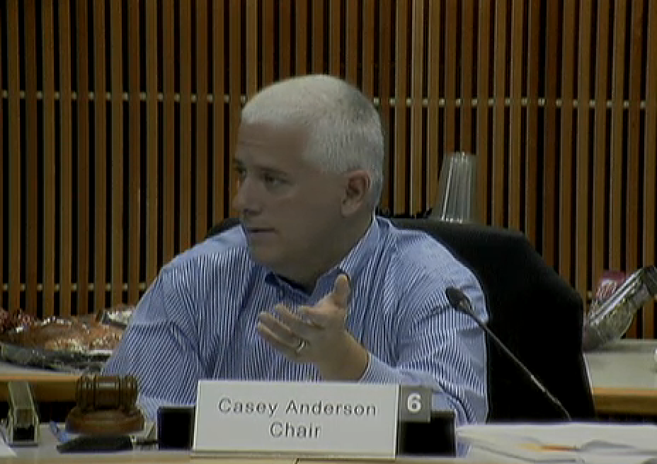
Planning Board Chairman Casey Anderson

Montgomery County Council

County Executive Ike Leggett

Dozier said that if everyone in the room sent just one email to each official, it would make a huge difference in the effort, which will determine "what our kids' neighborhoods will look like in the future."

I'd like to also have at least one major facility - i.e. a recreation center - and a significant park (not just a tiny, loud, skate park or green postage stamp) be added to the final Westbard Sector Plan. There are no County facilities in the Westbard area besides the Little Falls Library, and the area has been neglected for decades in that department.

Thursday, November 20, 2014

TOUR WILLETT BRANCH STREAM THIS SATURDAY IN BETHESDA

The Willett Branch Stream and I go way back - back to my very first day in Bethesda, just days after I was born. If you're new to Bethesda, or just want to learn more about some of the natural resources hidden away around here, you can join the Little Falls Watershed Alliance for a stream walk this Saturday, from 10:00 AM to noon, along the Willett Branch.

While the waters of this stream once flowed in a wider, natural path - and helped to power a mill in the vicinity of today's Little Falls Parkway - Willett Branch is mostly a channelized storm sewer today, running through concrete. A potential daylighting of tunneled sections, and a naturalization of the stream to its original state, are two potential outcomes of the Westbard Sector Plan rewrite currently underway.

See how it is currently this Saturday, in a walk alongside the creek's path starting at the Westwood Center II parking lot, at 5110 Ridgefield Road. The truly adventurous can make a return trip through the stream itself, although you'll want waterproof boots for that. Bring a flashlight, as well, for the return trip. While the entire tour will be on pavement, there is a steep grade to enter and exit the concrete creek bed. A round trip will be less than a mile.

The LFWA is hosting the walk to raise more awareness of the stream's fragile and contaminated state, and to advocate for improvements and a linear Willett Branch Park to be part of the Westbard Sector Plan recommendations. I'd like to see the beleaguered Willett Branch get the same protection in any future redevelopment in the Westbard area as Ten Mile Creek received in Clarksburg earlier this year.