|
| Kentbury Drive right-of-way |
 |
| Kentbury Drive right-of-way |
I contacted the Montgomery County Department of Transportation regarding the two proposed abandonments, which were difficult to locate on maps (more on that momentarily). MCDOT Property Acquistion Section Chief Eric Willis provided some very helpful information and documents for both.
 |
| Kentbury Drive right-of-way also extends to Rosedale Avenue (not part of the portion being sought for abandonment)... |
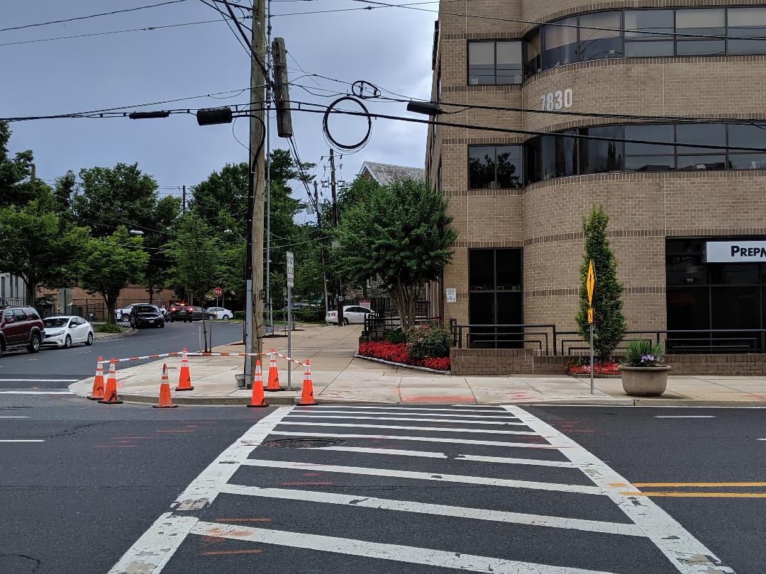
The portion of Kentbury Drive being sought by an adjoining property owner for abandonment is actually a grassy lot between homes that backs up to Columbia Country Club. On Google Maps, however, it is listed as Chestnut Street; a street sign in the center of the lot at the curb delineates the "real world" boundary of both roads. It is part of a longer ROW that actually connects Chestnut and Kentbury all the way over to the Lynbrook School Center.
 |
| ...and to Maple Avenue, creating a walking route to Lynbrook School Center |
But the public purpose of the segment being requested for abandonment is unclear - dedicated in 1949, it was already blocked from going any further east at that point by the country club, which has been there since 1911. The one conceivable use would be as a future road, bicycle or pedestrian connection if the Columbia Country Club were to be redeveloped - an unlikely but real possibility, if a plan by developers to tax country clubs out of existence (so that they can acquire those large sites for redevelopment) ever passes in Annapolis. A pedestrian connection would provide a mostly off-street walking route all the way to the Lynbrook School site and Lynbrook Local Park for kids in that case.
 |
| Unbuilt Andrus Road, off Greentree Road across from WMAL transmitter site |
Andrus Road has its own Google Maps-challenged identity. You see, Andrus Road doesn't exist. It was never built. But it is shown on a plat recorded in 1946. Intriguingly, at that time, Greentree Road was called "Cabin John Road," according to the plat map. Today, the ROW for Andrus Road sits between Barnett Road and Grubby Thicket Way, off Greentree Road toward the I-270 spur.
 |
| "Andrus Road" |
The abandonment request is for a 6700 SF portion of the ROW at the western end (at the I-270 spur). A developer is proposing to construct the rest of Andrus Road eastward from there to Greentree as part of a residential development project.
 |
| Andrus Road as recorded on a 1946 plat |
What's notable about this location is that it is directly across the street from the WMAL transmitter site, which is about to be redeveloped into a massive Toll Brothers community. Many residents in the area have noted that they walk their dogs on that property. So it would seem that there might be a need for a dog park there.
However, the road is listed on the historical plat, and the developer indeed plans to build it in this case. There may not be any legal standing to deny the abandonment for the purpose of a dog park. The property owners who would receive the abandoned ROW land will not have to compensate the County for them, Willis said. They do pay a $2500 abandonment processing fee, however.
Both abandonment requests are mainly notable for being coincidentally timed to major changes at one end or the other - the Toll Brothers project across from the future Andrus Road, and the possibility of Lynbrook School Center being reopened as a school.
Map images via MCDOT